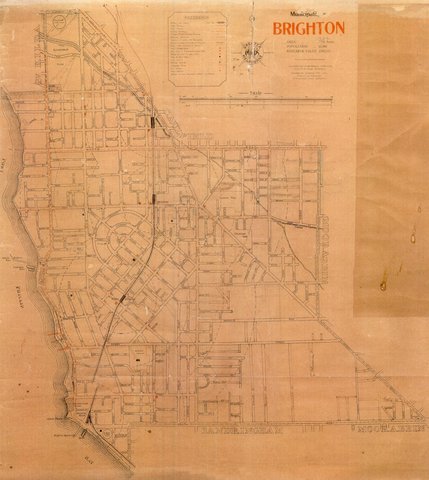
[n.d.] Map of the Municipality of Brighton
ID: 20123
Creator: Melbourne Publishing Co.
Copyright: library owns image (image on public access)
Org ID: 3maps1
Description: Map of the Municipality of Brighton. With an area of 332 acres and a population of 22,000 it is interesting to see the development along the railway line and beside Port Phillip Bay.
Subject: maps
Please Contact:
Bayside Library Service
Image held by Bayside Library Service
14 Wilson Street, Brighton, Victoria
Australia 3186
ph: 03 9591-5900
email: baysidelibrary@bayside.vic.gov.au
web: www.bayside.vic.gov.au/library
|


