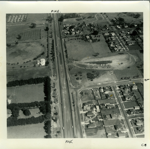
03/03/1970 Princes Highway Eumemmerring
ID: 21472
Creator: Shire of Berwick
Copyright: library owns image (image on public access)
Description: Looking west (or towards Dandenong) up the Prince Highway. Kays Avenue, Hallam, is just below centre right. It was taken at a 'height of 1,500 feet generally, down to 1,000 feet'. That is 450 metres down to 300 metres. The photograph has 'Eummemmerring Bypass from end of Mulgrave Bypass to South Gippsland Highway' on the back. Presumably, the series of photographs were taken along the route of the proposed road between Stud Road and the Princes Highway East, which would act as a by-pass to the City of Dandenong. This work started in 1969 and was finished in 1972.
Subject: aerial photographs
Please Contact:
Casey -Cardinia Library Corporation
Image held by Casey-Cardinia Local History Archive. For further information please contact the Local History Librarian at Narre Warren Library telephone (03) 9704 7696.
Postal address is Locked Bag 2400 Cranbourne 3977
www.cclc.vic.gov.au
|


